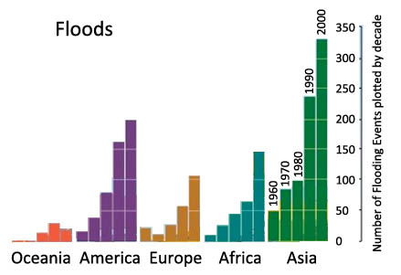
Figure 18.1 Flooding events in various regions of the world. Graphs show the number of floods classified as a disaster in the International Disaster Database of the University of Louvain, Belgium, for decades from 1950 through 2000. Floods resulted from rivers after heavy rainfall or snow melts, and coastal flooding. Data from the Millennium Ecosystem Assessment map (http://maps.grida.no/go/graphic/number-of-flood-events-by-continent-and-...).